Car2Go provides developer access to their real-time vehicle location and parking availability, and service area boundaries for all of their city locations around the world.
I was using the Car2Go API to power a website created for my own use after struggling with the official Car2Go map on their site when using my mobile phone. I wanted a way to find cars by street locations.
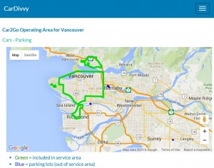
The site includes link to get vehicle location, parking lot location and service area boundaries on a Google Map. You can click into each city, view available cars alphabetically by street location or parking lot location, and then click through to car current location on a Google Map. Each city’s Car2Go service area can be viewed on a Google Map.
I am waiting for ZipCar to get their API up and running which should be available Fall 2015, then I will integrate that into the cardivvy site too so I can see where both cars are available.
This is example of Car2Go service area boundary for Vancouver area.
